Underground Utility Mapping (Real Estate - Other Real Estate Ads)

AUNetAds > Real Estate > Other Real Estate Ads
Item ID 2376168 in Category: Real Estate - Other Real Estate Ads
Underground Utility Mapping | |
Ground Penetrating Radar (GPR) survey is a non-destructive geophysical method used to accurately map and visualise subsurface features. In this article, we will explore how GPR works, the different types of GPR, and its wide range of applications, including utility mapping, archaeology, and environmental studies.We will discuss the benefits of GPR, its limitations, and provide tips on how to prepare for a GPR survey. Whether you are a professional or simply curious about this technology, this article will provide you with valuable insights into the world of GPR survey. 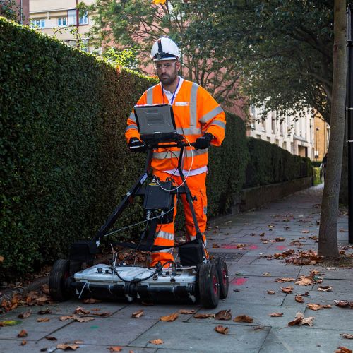 | |
| Related Link: Click here to visit item owner's website (2 hits) | |
| Target State: All States Target City : Spencer Last Update : 10 March 2024 2:01 AM Number of Views: 40 | Item Owner : Charles Drewry Contact Email: Contact Phone: 8559162366 |
| Friendly reminder: Click here to read some tips. | |
AUNetAds > Real Estate > Other Real Estate Ads
© 2024 AUNetAds.com
USNetAds.com | GetJob.us | CANetAds.com | UKAdsList.com | INNetAds.com | CNNetAds.com | Hot-Web-Ads.com | USAOnlineClassifieds.com
2024-05-06 (0.223 sec)